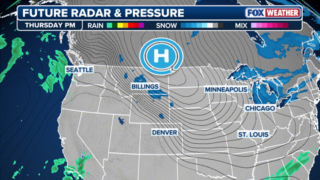
A potentially historic winter storm is set to sweep across the United States, placing more than 175 million people in over 30 states at risk of severe winter weather from Friday through early next week. The sprawling system is expected to stretch more than 2,000 miles, delivering a dangerous mix of heavy snow, crippling ice, and Arctic cold from the Southwest to the Mid-Atlantic.
Forecasters say the storm will emerge from the Southwest and push east through Texas and Oklahoma before spreading across the South, the Tennessee Valley, and eventually parts of the Mid-Atlantic. Winter Storm Watches have already been issued for millions, with officials warning that small changes in the storm’s track could determine whether communities see heavy snowfall or destructive ice.
One of the biggest concerns is the surge of Arctic air trailing behind the storm. Extremely cold temperatures could freeze snow and ice in place, increasing the risk of prolonged power outages, fallen trees, and hazardous travel conditions lasting several days. Airports along major corridors such as Interstate 20 and Interstate 40 are preparing for widespread delays and cancellations.
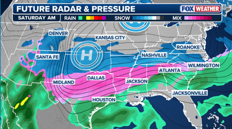
The Southern Plains are expected to be hit first, with Texas, Oklahoma, Arkansas, and Louisiana bracing for potentially historic snowfall and ice accumulation. Cities including Dallas, Oklahoma City, and Little Rock could see significant impacts, with some areas along I-35 forecast to receive more than a foot of snow. In Oklahoma City, the storm could rank among the largest snow events in the city’s history.
Farther south and east, ice poses the greatest threat. From central Texas through Tennessee and into the Carolinas, forecasters warn that up to half an inch of ice could accumulate in some areas. Such levels are enough to snap power lines, topple trees, and make roads nearly impassable. States like Georgia, South Carolina, Mississippi, and Louisiana are preparing for the possibility of widespread outages.
As the storm reaches the Southeast on Saturday, high pressure to the north is expected to funnel even colder air into the region, locking in snow and ice and preventing rapid melting. Parts of Tennessee and North Carolina could see heavy snowfall, with totals exceeding a foot in some locations, including areas around Nashville and western North Carolina.
Attention is also turning to the Mid-Atlantic, where uncertainty remains. Virginia and Maryland currently have the highest potential for significant snow, with the possibility of the region’s largest storm in years. If the storm track shifts farther north, snow could also impact major cities along the I-95 corridor, including Philadelphia and potentially New York City, late Sunday into Monday.
With the threat spanning much of the country, officials are urging residents to prepare now by limiting travel, stocking emergency supplies, and staying informed as forecasts evolve. As meteorologists stress, the combination of snow, ice, and prolonged cold could make this one of the most disruptive winter storms in years.
Check out our latest article: Brooklyn Peltz Beckham Says He Won’t Reconcile With His Parents